 you are not logged in

Initiatives & Projects

EMWIS on social media
![]()
![]()
![]()
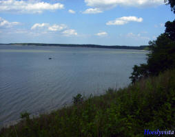
 Satellite Monitoring of Lake Water Quality in Egypt
The main objective of this project is to design, develop and implement an
Earth Observation (EO)-based capacity for the operational monitoring of
water quality in Lake Manzalah, Egypt.
The project team includes partners from Egypt, Canada and Finland: C-CORE
(Canada), Finnish Environment Institute (Finland), Water Resources
Management Division, Newfoundland and Labrador Department of Environment and
Conservation (Canada), Drainage Research Institute (Egypt) and Survey
Research Institute (Egypt).
| Project number | n/a | ||
|---|---|---|---|
| Subject(s) | MEASUREMENTS AND INSTRUMENTATION , METHTODOLOGY - STATISTICS - DECISION AID , WATER QUALITY | ||
| Acronym | Lake Quality Egypt | ||
| Geographical coverage | Egypt, Canada, Finland, Netherlands | ||
| Budget (in €) | 100000 | ||
| Programme | DUE (Data User Element of the Earth Observation Envelope Programme)- ESA | ||
| Web site | http://www.geoview.dynalias.com/tiger/ | ||
| Objectives | The main objective of this project is to design, develop and implement an
Earth Observation (EO)-based capacity for the operational monitoring of
water quality in Lake Manzalah, Egypt. Lakes are a precious source of
freshwater in Egypt, and the usage of lake water must be carefully managed
to satisfy a variety of different, and often competing, domestic,
agricultural and industrial uses. Key to the formulation of adequate water
management scenarios is accurate and reliable information on the occurrence
and distribution of water quality indicators, such as turbidity, algal
blooms or areas infested with invasive plant species. The project will
provide a set of comprehensive water quality products derived from EO data
in a regular manner. The extraction of water quality information from
satellite imagery will make use of the existing in-situ monitoring network
for data calibration and validation.
|
||
| Results | Responding to urgent user information requirements, the EO-based water quality products will represent an up-scaling in space and time of the conventional field measurements and will capture the spatiotemporal variability of critical lake water quality parameters more accurately than the current monitoring program. The final products will be made available to a wide range of local stakeholders. Weekly products to be generated include turbidity, chlorophyll-a concentration and suspended sediment concentration, while aquatic vegetation cover and reclaimed areas will be available on a monthly and quarterly basis, respectively. | ||
| Period | 01/01/2003 | ||
Login to add a comment
Page last updated:
02/09/2008
