 you are not logged in


- Regional water observation mechanism
- Regional Cooperation Assessment
- Water Quality Monitoring (JP)
- Water scarcity and drought (JP)
- Groundwater (JP)
- Waste water reuse (JP)
- Shared Water Resources Management (JP)
- Linking rural development and water management (JP)
- Waste management
- Water institutions
- Climate Change
- Floods
- Desalination
- Right to Water
- Irrigation
- Satellite data
- Water reports & data
- Hydrology
- Sanitation
- Gender and IWRM
- ArabWAYS
- Non-Revenue Water
- Virtual Water & Water Footprint
- WANA Water Panel
- Water Demand
- Water Governance
- Water Pricing
- Water accounts
- Water nexus Energy
- Geosciences
- Rural Management

![]()
![]()
![]()
 GeoEye-1 Satellite successfully launched
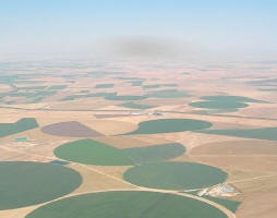
Satellite Imaging Corporation acquires and processes imagery from the groundbreaking GeoEye-1 satellite sensor. The satellite sensor launched on September 6, 2008.
The GeoEye-1 Satellite sensor was developed by GeoEye and features the most sophisticated technology ever used in a commercial remote sensing system.
GeoEye-1 is capable of acquiring image data at 0.41 meter panchromatic (B&W) and 1.65 meter multispectral resolution. It also features a revisit time of less than three days, as well as the ability to locate an object within just three meters of its physical location.
This newly developed sensor is optimized for large projects, as it can collect over 350,000 square kilometers of pan-sharpened multispectral satellite imagery every day.
| Contact information | n/a |
|---|---|
| News type | Inbrief |
| File link |
http://www.satimagingcorp.com/satellite-sensors/geoeye-1.html |
| Keyword(s) | GeoEye-1 |
| Subject(s) | METHTODOLOGY - STATISTICS - DECISION AID |
| Geographical coverage | International |
| News date | 18/09/2008 |
| Working language(s) | ENGLISH |
