 you are not logged in

![]()
![]()
![]()
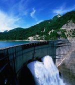
 Halting Desertification in the Jucar River Basin (HALT-JÚCAR-DES)
 |
 |
Introduction:
The current pilot action funded by the EC (DG Environment) started with the signing of an agreement on 21 December 2011.
The Coordinating entity is the Spanish Consulting firm Evaluación de Recursos Naturales, S.A. (EVREN), and the main partner is the Euro-Mediterranean Information System on know-how in the Water sector (EMWIS/SEMIDE). In addition, the Júcar River Basin Authority (CHJ) acts as a collaborating entity to ensure the coherence of data compilation and assessment.
The duration of the action is 12 months, and the works will be developed throughout 2012.
The objectives of the action:
This action aims at obtaining and assessing
socio-economic, environmental and climatic data, develop updated water accounts
according to water availability and existing demands in the
Specific objectives include:
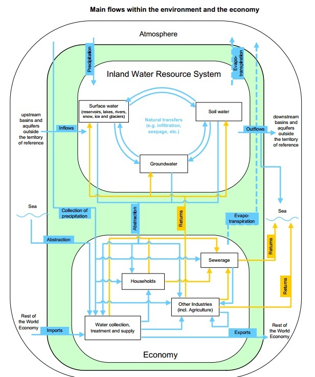
- Compile and assess data (flows, precipitation, evapotranspiration, climatic aspects, groundwater levels, demands etc.) and adapt them to the European Catchment and Rivers Network System (ECRINS) developed by the EEA; as well as to the UN System of Environmental-Economic Accounting for Water (SEEA-W).
- Propose a methodology for the management of data and their integration in the aforementioned systems.
- Obtain updated water accounts and detect desertification risks in the basin.
- Assess results and transmit them to managers and stakeholders through a participative process.
- Establish a series of recommendations for feasible water savings options and management measures targets.
- Transfer and disseminate results to EU and non-EU Mediterranean countries.
Tasks to be developed
The works of this action are divided in 6 main activities:
- Establishment of background and context.
- Collection of data and contacts with administrations and other partners.
- Use of ECRINS and SEEA-W with local data.
- Assessment and recommendations.
- Meetings and deliverables.
- Dissemination and capacity building.
Expected results
Through this action it is intended to share with the European water community the possibility of obtaining detailed water accounts that can
contribute to obtain a better knowledge on the European river basins status. In
addition, it will develop an assessment and identification of water saving and
management measures to halt desertification in the basin, through a sustainable
water use in harmony with the environment. This exercise will in turn
contribute to the political process “A Blueprint to safeguard
Kick-off meeting
The first meeting of the action took place in
The project duration was extended to 21 March 2013.


![]()
Posted by jauad at 11 Jun 2012 15:56:50
'ECRINS' is acronym for European catchments and RIvers network System. it is a fully connected system of watersheds, rivers, lakes, monororing stations, dams made from the JRC CCM2.1 and many other sources. Compared to CCM, ECRINS offers a smaller number (138,000 instead of >2,000,000) of elementary catchments which average size is 92km2. Only the main drainage system, nevertheless comprissing ~1,4 million km of rivers has been kept. The IG is organised in four folders. the "hydrography" provides the current and archived layers of ECRINS, the "documentation" provides the construction, coding and data models, "Ancillary data" provides computed data (e.g. Corine LC per elementary catchment) and "WISE data" the publicly available data sets reproted under the WFD and which end host is normally ECRINS. When updated data sets (e.g. lakes and dams, river naming, etc.) become avaiable, they will be added in the adequate folder.
The main sections of the Interest Group are:
- the Library containing the uploaded documents
- the About, which contains general information about the Interest Group
- the Member search where you can find other members of the Interest Group
Posted by jauad at 11 Jun 2012 16:00:13
