 you are not logged in


![]()
![]()
![]()
 Water service for GSE-Land
Aquapath project is an initiative integrated in the GMES program (Global Monitoring for Environment and Security). This project is an exytension to Portugal of the project GSE-Land (GMES Service Element Land Information Service), financed by ESA (European Space Agency).
Aquapath is coordenated by Instituto Superior Técnico (Maretec) and its partners are Instituto Geográfico Português and also two private companies: YDreams e Unitelco. The expected duration of the project is 12 months beginning on January 2008.
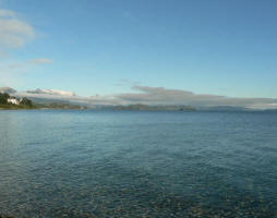
Aquapath will provide services and cartographic products related with water quality, which will allow to satisfy monitoring and watershed management needs. The geographic area that will be addressed will be Tagus watershed in Portugal.
| Project number | n/a | ||
|---|---|---|---|
| Subject(s) | MEASUREMENTS AND INSTRUMENTATION , METHTODOLOGY - STATISTICS - DECISION AID , NATURAL MEDIUM , POLICY-WATER POLICY AND WATER MANAGEMENT , PREVENTION AND NUISANCES POLLUTION , RISKS AND CLIMATOLOGY , WATER QUALITY | ||
| Acronym | Aquapath | ||
| Geographical coverage | Portugal | ||
| Budget (in €) | 0 | ||
| Programme | GMES program (Global Monitoring for Environment and Security) | ||
| Web site | http://www.aquapath.info/en | ||
| Objectives | Aquapath will provide services and cartographic products related with water quality, which will allow to satisfy monitoring and watershed management needs. | ||
| Results | Main tools of the project Modeling - Model SWAT
With this model it is possible to obtain results of water quantity and quality
Based on satelite images Land Use maps will be obtained.
Soil water content will be measured for calibrating the SWAT model. New comunication technologies will be used to dissiminate project results. |
||
| Period | [01/01/2008 - 31/12/2008] | ||
