 you are not logged in


![]()
![]()
![]()
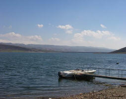
 Developing Renewable Ground Water Resources in Arid Lands: a Pilot Case - the Eastern Desert of Egypt
The project sought to find reliable techniques for evaluating the extent of
renewable groundwater resources which could be used for human demands and
also for the preservation of freshwater ecosystems in the in arid
areas.
(1) Develop reliable techniques for evaluating the extent of renewable
ground water resources in arid lands, with the Eastern Desert of Egypt as a
test site. Our preliminary geochemical and isotopic data indicated that
flash flood waters stored in shallow aquifers during the past 45 years are
the source of the shallow (10?100 m) groundwater in Wadi El Tarfa and
surrounding areas in the Eastern Desert (Appendix I).
(2) Evaluate the source(s) of the groundwater in the alluvial aquifers of
the Eastern Desert, the timing of their recharge cycle, and the extent of
the renewable groundwater resources recharged by rainwater precipitating
over the Red Sea Hills area in the Eastern Desert.
(3) Investigate groundwater flow in the alluvial aquifers flooring one of
the main valleys of the Eastern Desert.
(4) Produce a replicable model in neighboring Middle Eastern and Saharan
countries and thus contribute to the preservation of freshwater ecosystems
in the area.
| Project number | UNDP PMIS ID: 1815 | ||
|---|---|---|---|
| Subject(s) | HYDRAULICS - HYDROLOGY , METHTODOLOGY - STATISTICS - DECISION AID , RISKS AND CLIMATOLOGY , WATER DEMAND | ||
| Geographical coverage | Egypt | ||
| Budget (in €) | 1237524 | ||
| Programme | GEF/UNDP - United Nations Development Programme | ||
| Web site | http://www.esrs.wmich.edu/UNDP-IMS.htm | ||
| Objectives | The purpose of this project is to develop and demonstrate ways to integrate renewable groundwater resources into water budget of watersheds in arid regions. The project team is conducting comprehensive studies leading to the development, validation and demonstration of techniques which are being used to evaluate the extent of alternative water resources arising from sporadic precipitation over large watersheds in arid and semi-arid mountainous areas. The Eastern Desert of Egypt is being used as the test site. The comprehensive techniques encompass the use of various geochemical and isotopic techniques, surface and ground water modeling, analysis of Landsat and digital elevation data, seismic and drilling data and field observations. | ||
| Results | 1.1 Develop and maintain a laboratory for hydrologic modeling at CU,
Engineering school 1.2 Assist in the selection of the core (full-time) project administration 1.3 Provide guidance in the preparation of the TOR for the individual tasks 1.4 Develop methods/procedures to facilitate the communications between CU and the IC 1.5 Design an information system to host all relevant data layers; Establish a web-based GIS site that will incorporate and distribute the data 1.6 Construct a web page 1.7 Organize a short course (3-5 days) on the use of isotopic and geochemical data to investigate the sources of groundwater 1.8 Assist in the review and compilation of existing studies and data 1.9 Provide a methodology for a prioritization scheme for wadi systems 1.10 Conduct a field trip (10-14 days) to collect groundwater and surface water samples for geochemical, (anions, cations, alkalinity) and isotopic analyses (O,H, tritium) 1.11 Identify and conduct geochemical and isotopic analyses for water and soil samples in appropriate laboratories 1.12 Analyze acquired and published geochemical, isotopic, field and head information collected for the alluvial aquifers of the Eastern Desert for the purpose of identifying the origin and evolution of groundwater 1.13 Compute recharge rate using the chloride mass-balance approach using collected soil salinity data 1.14 Organize training course(s) in the general area of remote sensing and image processing 1.15 Generate a digital mosaic of geo-referenced Landsat Thematic Mapper data over the entire Eastern Desert 1.16 Generate a digital mosaic from 1:500,000 geologic maps & digital elevation 1.17 Generate a regional digital distribution map for soil and rock hydrologic characteristics 1.18 Co-register the digital mosaics (e.g., digital elevation, TM, geology, soil, etc) to a common projection (UTM) 1.19 Set up a network of rain gauges 1.20 Identify and install appropriate locations for stream flow gauges 1.21 Acquire training on the use of surface runoff modeling (WMS software) 1.22 Construct a surface runoff model 1.23 Select the most appropriate watershed(s) to conduct groundwater studies 1.24 Develop a conceptual ground water flow model for the selected watershed using geophysical and well data 1.25 Provide a 3-5 day training course on relevant modules in GMS 1.26 Construct and calibrate a groundwater flow model for the selected watershed 1.27 Construct steady-state and transient simulations 1.28 Explore the utility of recently developed commercial software for coupled surface runoff/groundwater flow models for the selected valley. 1.29 Conduct routine reporting (quarterly and annually) to CU 1.30 Together with the PM represent results in refereed international journals 1.31 Assist in the preparation of Environmental Impact Assessment SELECTED PROJECT ACTIVITIES/RESULTS:• A laboratory for hydrologic modeling was set up at Cairo University (CU) Faculty of Engineering and field trips were organized to collect groundwater samples, relevant hydrologic parameters, and geologic observations.• The project used various geochemical and isotopic techniques; surface and groundwater modeling; analysis of Landsat, digital elevation, seismic, and drilling data; and field observations making it the most comprehensive study of its type in Saharan Africa and in neighboring arid and semi-arid countries. Project methodology and results provide a model which could replicated in neighboring Middle Eastern and Saharan countries, as well as in Nile valley countries. • Groundwater samples from the project site area were analyzed for chemical composition. Data indicated that the most likely source of the water was indeed sporadic flash floods and that the magnitude of this renewable resource could help support human demands and sustainable agriculture. • The University of Illinois, USA, assisted the project in preparing a report on Geochemical and Isotopic constraints on the origin of the Eastern Desert groundwater. The University of Buffalo also provided a consultancy to the project. • The project assessed water resources potential in areas where farming communities have been neglected for decades and therefore could play a role in alleviating their poverty. • Successful cooperation between the project and Cairo University could provide a model for linking academic sector to field work institutions through target research. The involvement of partners from developed countries, such as American universities, has helped accelerating transfer of scientific expertise and new technology. • The project results show that the Eastern desert region has the potential for future development and investment and that with careful planning sustainable development can be encouraged in this region and similar hyper-arid locations. Legal • The project’s findings have ensured that water resources development in the Eastern desert is now included within the water policy working plan of the Ministry of Water Resources and Irrigation. • Communications• The project was publicized through a series of national and international meetings including: three talks given to the Center for Environment and Development for the Arab Region and Europe (CEDARE); in a presentation made to a GEF-organized International Waters conference in Salvador, Brazil (June 2005); at a conference in New Delhi on Aquifier Recharge Management, organized by UNESCO and GEF, and during the Fourth World Water Forum (4WWF) in Mexico (March 2006).• A website giving full details of the project’s scientific finding was organized by the University of Michigan. Training• The project conducted many training courses with around 100 participants. As a result scientists from Cairo University, National Wetlands Research Center (NWRC) and the Ministry of Water Resources and Irrigation (MWRI) have been trained in groundwater modeling, use of new technology in remote sensing and other hydrologic techniques. When the project is completed, they will be able to provide scientific, technical and practical guidance to other scientists in Egypt and neighbouring countries.• The involvement of students from Cairo University in coordinating and implementing the project helped them work towards their MSc or Ph.D degrees. |
||
| Period | 08/03/2003 | ||
